Peaks of the Balkans | 10 days

Age

14 +

Duration

10 day(s)

Group size

4 +

Difficulty

Challenging

Season

Summer, Autumn

Price

1170 €/per person

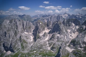
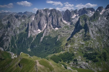
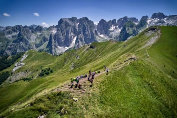
Peaks of the Balkans is the first lengthy hiking trail to traverse the Western Balkans, an area where ancient tracks connect remote regions. The epic walk passes through villages, separated by strict borders and fortified by bunkers that were built over two generations when communist regimes controlled Yugoslavia and Albania. Winding through meadows, mountain peaks, lakes, and woodlands, this is one of the most diverse walking trails in the world. The views and the trails transform, switching from rocky paths and bare peaks to meadows rich with flowers and plants, where nature has been left to run wild. In stark comparison to Western Europe, where the grass is not cut, and the land is left alone for nature to follow its course.

2025 departures: May 24 – June 3;  June 14 – 24;    July 5 – 15;    July 19 – 29;    August 9 – 19;    August 23 – September 2;    September 6 – 16;    September 20 – 30;   October 4 – 14;

PACKAGE INCLUDES:

Accommodation in shared rooms, 10 nights

Meals: 2nd to 9th day three meals; 10th day breakfast and lunch package

Guide

All internal transfers

Border crossing permits

Entrance fees for the National Parks

GPS files and route notes (for self guided tours)

PACKAGE EXCLUDES:

Luggage transfer can be offered on demand.

Airport pickup can be provided on demand.

Insurance should be secured by the travelers

Meeting the guide and the group for a short briefing from 20:00 – 21:00 hrs. Podgorica Airport (1 hr 30 min from the start location), Tirana Airport (1 hr 30 min from the start location), Tivat International Airport (2 hrs 40 min from the start location) Prishtina Airport (3 hrs 40 min from the start location), Skopje International Airport (4 hrs 40 min).

The transfer from the airport and back can be provided on demand with additional payment.

Your first day on Peaks of the Balkans will start with a transfer from Shkodra to the village of Nderlyse, a small hamlet at the foot of the Peaks of the Balkans trail. The village is home to the Shala River, which has created waterfalls and rock formations similar to baths and pools. After a short exploration, you will start your journey walking toward Theth with an easy hike.

Cultural note: Ndërlyse and Theth are two Roman Catholic villages that are home to some small churches. In Ndërlyse there are the small remains of the Saint Veneranda Church, however, locals still go there to celebrate the saint every 25th of July. The most spectacular building is in Theth, the Lock Tower (Kulla e Ngujimit), which served as a self-imposed prison for wanted murderers sought out for revenge killings under the Kanun law.

Length of the hike: 11.5 km (7.1 miles) Uphill walking: 266 m (872 ft) Downhill walk: 435 m (1427 ft)

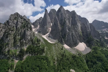
 At this hike, you will have a real taste of the Accursed Mountains and the Peaks of the Balkans Trail. It’s a diverse hike bookended with mountain villages and filled with picturesque views. You will walk through meadows, woodland, rocky terrain, and crests and see the most southern glacier in the Northern Hemisphere.  This trail has very few tourists, despite its highlights-filled experience.

Cultural Note: Valbona is a Muslim-majority valley with some Catholics who migrated from Theth. There is a legend that the village was founded by an orphan who moved there from Vuthaj/Vusanje, in present-day Montenegro.

Length of the hike: 19.5 km (12 miles) Uphill walking: 1068 m (3503 ft) Downhill walking: 850 m (2788 ft)

This trail will take you to the Montenegrin border and the country’s highest peak, Kollata e Keqe. For a strong group, the peak can be included in the itinerary. Adding the peak would make this the highest and longest hike of the trip. (to add the peak in the hike we need advance notice)

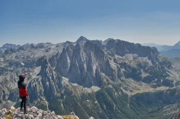
We included this diversion from the classic Peaks of the Balkans trail in order to avoid walking on gravelly, dusty tractor roads. From the highest point of the hike, you will see mountain ranges extending to all three countries.

Cultural note: Cerem is a small village, largely abandoned, and at the moment is populated only during the summertime by shepherds. During the winter the village is empty due to the poor conditions and the road which connects the village with Valbone is blocked by snow.

Length of the hike: 14.9 km (9.2 miles) Uphill Walking: 1200 m (3937 ft) Downhill walking: 950 m (3116 ft)

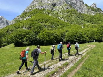
After two days of mixed hiking in diverse environments, this track will be dominated by greenery. The entire hike to Doberdol will expose you to the abundant flora of the region that fills the pastures. Villagers on the way will offer their natural products but also other drinks and refreshments. Two makeshift cafes under a canopy of trees give a unique charm to this trail. The scenery will be also filled with sheep, goats, cows, and horses that support the local economy. On this trail, you will pass by some of the oldest woodlands in the world.

Cultural note: Gashi Valley starts in this region. The woodlands have been under UNESCO protection since 2017 as part of the Primeval Beech Forests of the Carpathians. The woodlands are also part of the Ancient Beech Forests of Germany that now stretch over 12 countries.

Length of the hike: 15.5 km (9.6 miles) Uphill walk: 1030 m (3379 ft) Downhill walk: 440 m (1443 ft)

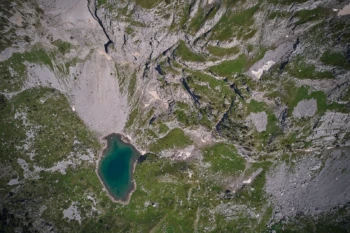
You can climb the highest peak of Kosovo, Gjeravica or just spend the day on a plateau above the tree line with shepherds, goats, sheep, and cows. Balkan Natural Adventure, Peaks of the Balkans 2024 version includes this optional day for hikers. While this is a loop path, it goes through lakes, small streams, and crests with open views of the mountains. The specificity of this trail is the glacial lakes that are home to the Triton salamander, whose existence verified the purity of the water.

Cultural note: This is a loop path that will take you to Kosovo, a border that is almost not protected at all. However, during the communist regimes in this part of the world, this was the border between Albania and Yugoslavia and one of the most protected borders in the world.

Length of the hike: 18 km (11.1 miles) Uphill walk: 915 m (3001 ft) Downhill walk: 915 m (3001 ft)

While one day before, you walked to Kosovo and went back to Albania, today you go to Kosovo for a sleepover. On this trail you will go by the three-border peak, taking in a view from the place where the three borders meet. The characteristic of this trail is that both Doberdol and Milishevc are not villages but summer camps for shepherds. Additionally, they are the most remote locations on the trail making this hike very special. Cultural note: Milisevc is a small remote summer settlement, which has a good connection with the city of Peja and more and more mountain huts in the village are being used for tourist purposes.

Length of the hike: 15.8 km (9.8 miles) Uphill walk: 915 m (3001 ft) Downhill walk 980 m (3215 ft)

This Peak of the Balkans 2024 hike section is a detour from the classic trail. Balkan Natural Adventure decided to make this detour to save you from some parts of the hike that are less attractive. Additionally, you will avoid some car transfers. The hike will go through some of the least trodden Accursed Mountain trails in the Kosovo section. You will join the classic trail in the Liqenat to Babino Polje section that will go through Zavoj Ravno Selo.

Cultural note: Babino Polje (meaning ‘Grandma’s fields’) is a very beautiful place located on the way of the trails of the Peaks of Balkans in Montenegro. The Montenegrin Muslims living in Babino Polje abound with hospitality. Do not forget to have a glass of rakija with them.

Length of the hike: 14.6 km (9 miles) Uphill walk: 957 m (3139 ft) Downhill walk: 790 m (2591 ft)

What's included:

✔️ Accommodation
✔️ Border crossing permits
✔️ Transfers during the tour
✔️ Food: Breakfast, Lunch or lunch package, Dinner
✔️ Entry fees for National parks
✔️ Experienced English speaking guide

What's NOT included:

❌ Flights to and from Montenegro
❌ Insurance during the tour
❌ Drinks
❌ Personal costs

Important Notes

  • The exact activities on the itinerary may change depending on the time of year, weather conditions and other factors beyond our control. If an activity is cancelled due to inappropriate weather conditions we will endeavor to replace this with another activity. However, clients should accept that sometimes, for reasons of safety, an activity will need to be cancelled or postponed and we may not be able to offer a similar replacement due to location or weather. Tour guide always makes the final and irrevocable decision regarding the tour – OUR TOP PRIORITY IS SAFETY OF GUESTS!
  • Keep in mind that you can be with other participants on tour. We organize exclusively private tours for 4+ participants. Our groups usually are not bigger than 8 members.
  • Keep in mind that every day our experienced guide can adapt tour – make alternatives to secure full enjoyment.

Please complete the form below and we will be back to you as soon as possible. All fields in the form are required. Due to the nature of our tours we naturally expect complete honest insight into your current abilities. In some circumstances we may request additional information of your skill set.

Share this tour